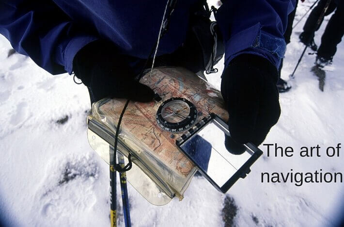
Managing mountain navigation in the Scottish Highlands
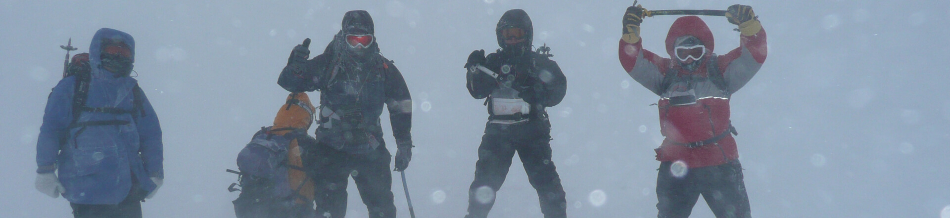
As we move into late autumn and early winter, the mountains change character. The contrast between relatively warm seas and colder air masses fuels more energetic, fast-moving weather systems. Add shorter days, fresh snow cover and the possibility of flat light – when snow and cloud merge into one seamless white – and navigation becomes more committing.
But this doesn’t mean it’s time to hang up the boots until spring.
It does mean it’s worth sharpening your skills and adapting your approach.
At Scot Mountain Holidays, we see winter navigation not as a “black art”, but as a structured skillset built on good habits, clear thinking and practice. Even in a full white-out on the Cairngorm Plateau, navigation isn’t mysterious – it’s methodical.
Navigation accuracy: skill vs error management
In our experience, mountain navigation operates on two levels:
-
Accuracy in individual techniques (bearing, pacing, timing, contour interpretation).
-
Overriding error management – how you prevent small inaccuracies becoming serious problems.
It’s easy to focus on perfecting a single technique. But the mountain environment contains too many variables – wind drift, uneven terrain, fatigue, snow conditions – to rely on just one tool.
Error management is what keeps you safe.
1. A tactical approach to navigation
In simple terms:
If your distance and direction are accurate, you will reach your objective.
Most navigational errors occur when small inaccuracies in these two elements are allowed to grow unchecked.
A key principle we teach:
Never allow your estimated error in distance or direction to exceed your range of visibility.
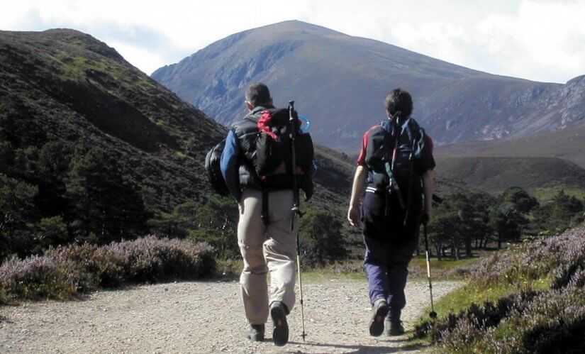
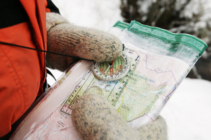
In winter, that often means keeping your navigational “legs” shorter – ideally under 1 km – and using more intermediate features. This demands strong contour interpretation.
You may hear people describe the Cairngorm Plateau as “featureless”. It isn’t. The features are subtle: shallow re-entrants, gentle domes, faint breaks of slope. Spotting them requires confident map reading and the ability to visualise terrain in three dimensions.
That 3D picture in your mind is what anchors everything else.
2. Don’t Put All Your Eggs in One Basket
A common mistake is over-reliance on one technique – for example, pacing alone.
Strong winter navigators layer techniques so they confirm each other:
-
Bearing
-
Pacing
-
Timing
-
Slope angle
-
Wind direction
-
Contour interpretation
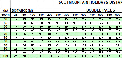
One practical tool we use on our courses is a detailed pacing and timing chart. For example, if your double pace rate is 70 and you expect 595 double paces over 850 m, finishing at 616 paces may still fall within acceptable error. But being 20+ paces out over a short 150 m leg would be a red flag.
That information becomes meaningful when interpreted alongside everything else you’re observing.
Navigation is about cross-checking – constantly.
3. Techniques That Correct Error
Good navigators don’t just measure – they manage.
Techniques such as:
-
Aiming off
-
Attack points
-
Collection features
…are specifically designed to control and correct error.
Used well, they improve both safety and efficiency. They give you defined decision points rather than vague hope that “we should be somewhere around here”.
4. Contour Interpretation: The Core Skill
If there’s one foundation skill in mountain navigation, it’s contour interpretation.
Everything else feeds back into your understanding of the ground beneath your boots.
In the worst winter conditions, your sense of the terrain’s shape may be the first – and sometimes only – clue that you are drifting off bearing. When visibility collapses, your ability to “feel” and visualise the landscape becomes critical.
This is what transforms navigation from mechanical to intuitive.
Test Your Limits — Within Your Means
Winter navigation is immensely satisfying. Moving confidently across a snow-covered plateau in challenging conditions is a skill that builds resilience and independence.
If you’d like to develop that confidence in a structured, supportive environment, we run:
-
Navigation courses (ideal for sharpening core skills)
-
5-day Winter Skills Courses in the Cairngorms
All based from our welcoming lodge in the heart of the Highlands, with expert instruction, small groups and plenty of time to practise properly.
You don’t need to wait for perfect weather. In fact, some of the best learning happens when the weather isn’t playing ball.
If you’d like to join us in the hills this winter, we’d be delighted to help you build the skills that keep mountain days enjoyable — whatever the forecast.