Nothing about mountain navigation is rocket science. Then again it is not a god given talent either. It does though require both a good understanding and the right approach to deal with the worst conditions in the mountains.
In good conditions with good visibility you can quite successfully navigate without reaching for your compass. Neither will you need to resort to the “dead reckoning” techniques of timing and pacing to gauge your distance. By relating the features on the map to those on the ground you can safely get to your destination. Some of those features will be man-made like field boundaries. Other more obvious natural features include streams or ponds or lakes. But many of those features, especially in Scotland, will be made up of a combination of a change in gradient and a change in slope aspect (which way the slope faces).
Take a little rounded hill (knoll) for instance: as you rise up onto it the gradient will increase before flattening out on the summit.The gradient then increases again as you drop down the other side. It will be shallower again at the bottom. If you were to walk around its flanks you would continually experience a change in slope aspect. If we think about other features like ridges, spurs, valleys, gullies, saddles, etc, they’re all a combination of changing gradient and slope aspect. Both slope aspect and gradient are indicated by contour lines.
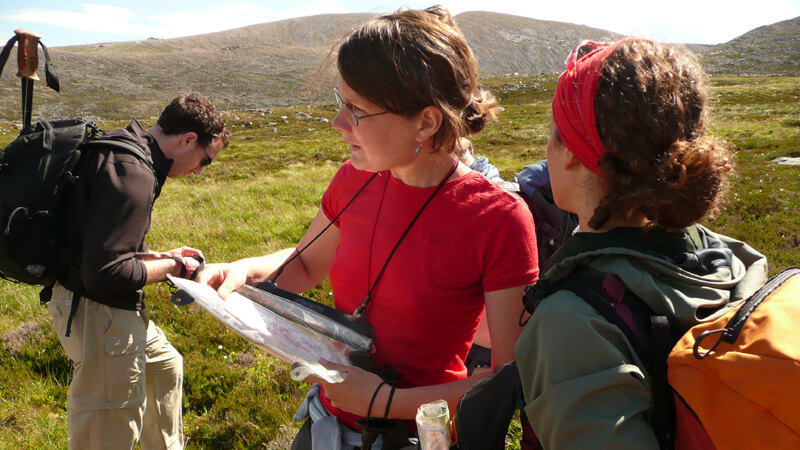
Map reading in the Cairngorms
Accuracy in a particular skill is important. However the key aspect of accurate Mountain Navigation is your ability to manage error. It’s a fatal mistake rely too much on the absolute accuracy of a few skills. Don’t ignore the importance of applying techniques or strategies that reduce or negate the effect of error. If we think how most folks get lost on the mountains it’s when they are trying to navigate to a point beyond their range of visibility. One strategy is to keep your navigational legs short. A 10% error in distance or direction over 2 km will be 4 times that over 500m. But if we are to do this we will need to be able to identify more way-marking points. This, especially in Scotland, often comes down to contour features.
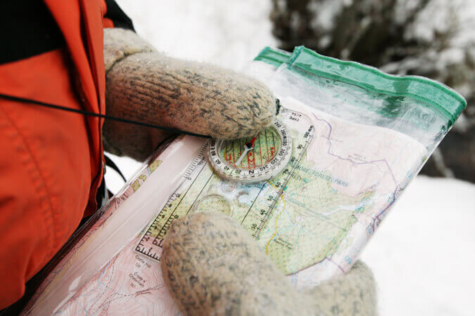
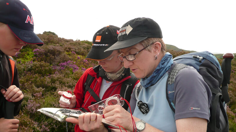
Dachstein mitts don’t necessarily mean that you won’t be able to use a compass or to navigate, as shown by our director Andy Bateman
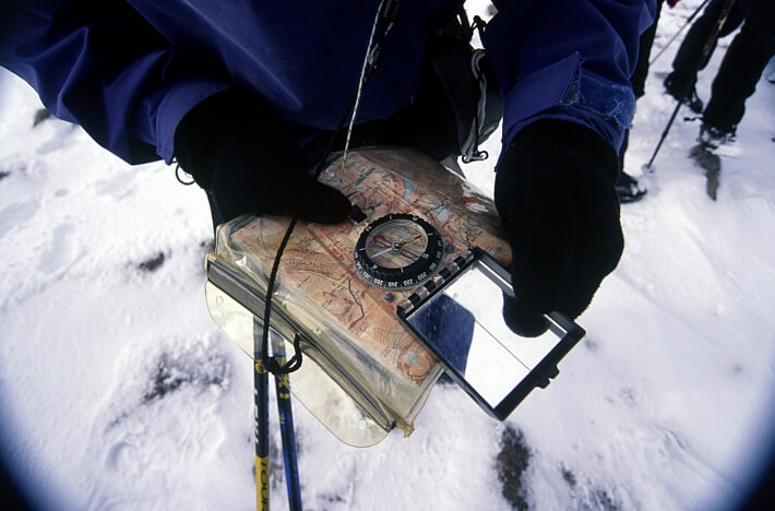
In winter whiteout conditions where you are, let’s say making a descending traverse, where you have no horizon and loose the definition of slopes and other features, it can be very difficult to stay on a compass bearing. But again it may be a change in the gradient or slope aspect which maybe the first (and maybe only) indication that you have drifted off your compass bearing. Bad visibility of course encourages you to abandon any attempt at interpreting the lie of the land. This is the last thing you want to do and it’s even more important that you keep a close eye on the terrain.
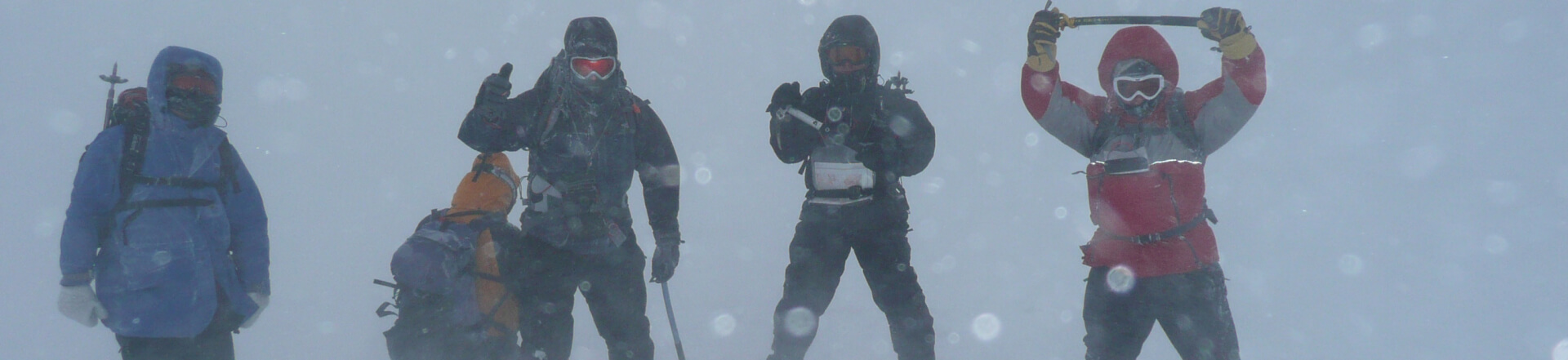
Test your limits, within your means
It all comes back to you contour interpretation. This is the crux of good mountain navigation and around which all the other navigational skills like compass bearings fit and relate. Of course this all makes perfect sense when you consider, by definition, mountains are composed of slopes and in turn those slopes must have an aspect and gradient. It is very important that all the various navigational skills and techniques are related to each other and not taught in isolation. One of the common points of failure on Summer ML assessments is when candidates place an over reliance on compass bearings and timing and pacing techniques and don’t develop their contour interpretation skills. Your “dead reckoning” skills are of course important and you would never be without you compass on the hill but they are in effect auxiliary skills, albeit very important ones, to your contour interpretation.
Andy Bateman, Scot Mountain Holidays, 26/3/15. (updated 14.01.2020)
Mountain Navigation by Peter Cliff:
Weather for Hillwalkers and Climbers by Malcolm Thomas
Mountaincraft and Leadership by Eric Langmuir
Hillwalking the official handbook of the mountain leader by Steve Long
Winter Skills: Essential walking and climbing techniques by Andy Cunningham
Useful links:
Mountaineering Council of Scotland:
British Mountaineering Council:
British Association of International Mountain Leaders:
Mountain Training Association:
Autumn and early winter is the time when the contrast between warm seas and cold air is at its greatest. This has the effect of injecting even more energy into our already turbulent skies. Then the weather at this time is even more changeable. In addition, the ground is often covered by snow. The snow covered ground merges with the cloud. Flat light conditions as well will make navigation even more difficult as everything you see appears to be the same colour. This doesn’t mean that you need to hand up the mountain boots until Spring. It might mean that you should consider brushing up on your navigation skills so you can deal with the shorter days (flat light) and the potential for more inclement weather (autumn/winter).
Winter navigation has been described as a bit of a “black art”. This isn’t a particularly helpful phase for anyone trying to get their head around the subject. Dealing with even the worst of winter white-outs isn’t rocket science. It does require the right approach, mindset and plenty of practice.
Navigation accuracy operates on two levels:
There are so many variables in the mountain environment that it is important not to overlook “error management”. Looking back to when I did my summer ML many moons ago I had too much focus on the former and didn’t really appreciate the latter.
Logically if we get our distance and direction right we will get to our objective. The most common way people get lost in the mountains is when they allow an error in their distance and direction to get out of control. You must never allow an error in your distance and direction estimate to become greater than the range of visibility. A 10 % error in distance or direction over 500m will be a quarter of that over 2 km in real terms.
Keeping your navigational legs to below 1 km in winter should be one of your key aims but to do this requires more waymarking points/features. For this you’re invariably looking to your contour interpretation skills. On many occasion I have heard it be said “the Cairngorm Plateau is featureless”. It isn’t, it’s just that the features are often a lot more subtle. You need to be a skilled map reader to pick them out.
Don’t “put all your eggs in one basket”. Accuracy in one particular technique or skill is good but don’t let this tempt you into relying on one or two techniques. By employing a number of skills simultaneously they should confirm each other.
An additional technique that I and mountain navigation course students have found very useful is to use a very comprehensive and detailed timing & pacing chart (see extract below). In the extreme left hand column you have your double pace rate (dp) with the distance running along the top. Working on the basis of + or – 5 double paces per 100m is within the realm of acceptable error, it gives you the acceptable error for a particular distance.
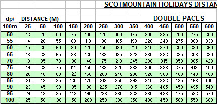
For example, if you estimated you’re going to do 595 dp’s over for 850m (dp rate of 70) and you end up doing 616, a quick reference to the chart shows you that this figure lies neatly between what you estimated and the next rate up of 638 dp ie within the acceptable range of error. To be 21 dp out over 150 would be well off the mark. This information can then be used in conjunction to what other skills and techniques are indicating about your position.
With all the tactical techniques of aiming off, attach points and collection features, at some stage in their execution they all correct the error. If applied appropriately they can be used to great effect and can improve you overall accuracy and efficiency
Contour interpretation and having that 3D image of terrain in your mind is the focal point of mountain navigation skill. It is what the information fed back from all the other skills and techniques relates to. In the worst conditions you contour interpretation skills it may offer the first and only indication that your drifting off your bearing.
To try any of these techniques in practice book one of our navigation courses or a 5 day winter skills course.
![]() Scot Mountain Holidays (Ltd),
Fraoch Lodge, Deshar Road,
Boat of Garten,
PH24 3BN
Scot Mountain Holidays (Ltd),
Fraoch Lodge, Deshar Road,
Boat of Garten,
PH24 3BN


All content © Copyright Scot Mountain Holidays 2025
Responsive web design by Summit Web Solutions
